{Click on an image to enlarge, then use the back button to return to this page}
This page last updated on 06/17/2017
 |
| (Fig.01) |
05/18/2017 Trip Notes: Today, Bob Croke, Blake Smith and myself visited Valley of Fire to hike the Rainbow Vista and Canyon Overlook Trails. Driving along the Lake Mead Northshore Road on the way there, we spotted a family of three wild horses just off the road (Fig. 02). Using our telephoto lenses we took dozens of pictures. The shot in (Fig. 03), showing the affection of mother and child was taken by Bob Croke. I captured the one in (Fig. 04). These wild horses were some of the most beautiful horses we have encountered in a long time. For Bob and I, this was our second visit hiking here. However, on our first visit we only hiked to the Fire Canyon Overlook and didn't hike the Rainbow Vista Trail (see Fig. 05). So this time, from the trailhead we hiked the Rainbow Vista Trail to (A) on the map in (Fig. 05), the highest point of the trail. Walking across the desert, before reaching the top we spotted a group of 13 Desert Bighorn Sheep (Fig. 06) in the lower portion of the valley. My esteemed hiking partners, Blake and Bob (Fig. 07). Turning east we then began the climb up the 100 foot high sandstone outcrop that was the highest point of the Rainbow Vista Trail (Fig. 08). When we finally reached the top of the high outcrop, looking west across the valley below, we were presented with the beautiful view seen in (Fig. 01) above. Stunning! Turning 180-degrees east, we had a view towards Silica Dome (Fig. 09). From here we then had a rather steep, winding hike down to the sandy area below, and the trail to the Fire Canyon Overlook (Fig. 10). (Notes con't below)
 |
| (Fig. 02) |
 |
| (Fig. 03) |
 |
| (Fig. 04) |
 |
| (Fig. 05) |
 |
| (Fig. 06) |
 |
| (Fig. 07) |
 |
| (Fig. 08) |
 |
| (Fig. 09) |
 |
| (Fig. 10) |
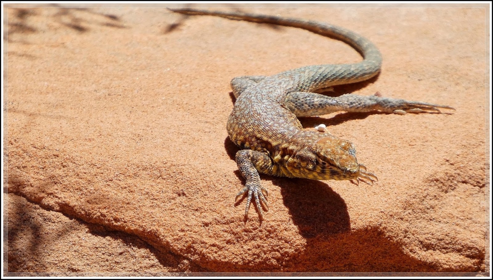
Hike Notes Continued: After reaching the bottom of the steep trail, we headed south along the Fire Canyon Overlook Trail. Along the way we walk past more than a half dozen large lizards sunning themselves in the sand and on the rocks (Figs. 11 thru 14). From the girth of the lizard in (Fig. 14) I suspect that she was pregnant. At the end of this trail, the overlook looks 50 feet down into Fire Canyon (Fig. 14). At this point we all took a well deserved rest, some water and a power bar, before the up hill return hike (Fig. 15). (Figs. 16 thru 20) are pictures of some of the plants and vegetation we found along this trail hike. One of my hiking friends, Kathy Pool, helped me identify the plant in (Figs. 16 & 17). It is Desert Milkweed. Check it out here...
Desert Milkweed (Asclepias subulata). A final look at the beautiful horses we observed earlier (Fig. 21).
 |
| (Fig. 10) Taken by Bob Croke |
 |
| (Fig. 11) |
 |
| (Fig. 12) |
 |
| (Fig. 13) |
 |
(Fig. 14)
|
 |
| (Fig. 15) |
 |
| (Fig. 16) |
 |
| (Fig. 17) |
 |
| (Fig. 18) |
 |
| (Fig. 19) |
 |
| (Fig.20) |
 |
| (Fig. 21) |