{Click on an image to enlarge, then use the back button to return to this page}
This page last updated on 04/13/2017
 |
| (Fig. 01) |
|
 |
| (Fig. 02) |
|
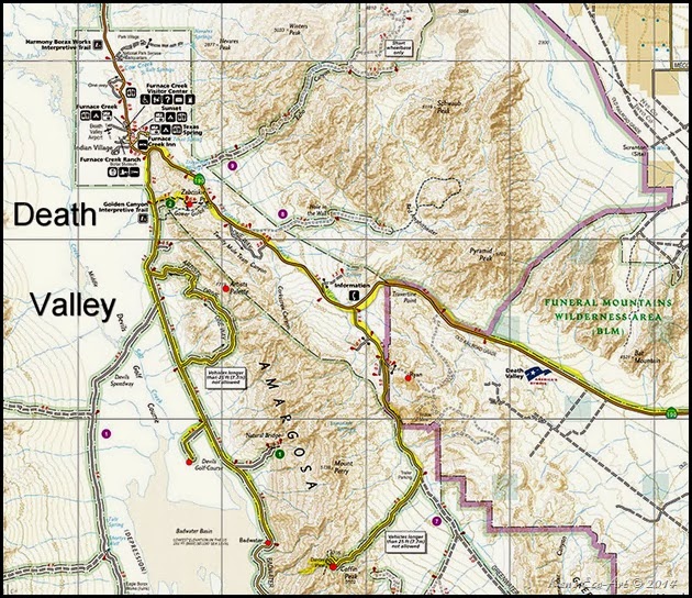
| Directions: From the Stratosphere Casino head southwest on S Las Vegas Blvd toward W Baltimore Ave. Travel 1.7 miles and turn right onto Spring Mountain Rd. Go .7 miles and turn left to merge onto I-15 South. Follow for 5.4 miles and take exit 33 to merge onto NV-160 W/Blue Diamond Rd/State Route 160 W toward Pahrump. Continue to follow NV-160 W/State Route 160 West for 55 miles In Pahrump, continue straight on Hwy. 160 through three stoplights then drive 3.1 miles. Turn left at Bell Vista Road and continue 25.5 miles to Death Valley Junction. Turn right and then immediately left on CA Hwy 190 and drive 26 miles and turn left onto Furnace Creek Wash Road (see Fig. 02). After about 8-9 miles, bear to the right onto Dante’s View Road and drive about five more miles to the end. |
| |
Dante’s View: Dante's View, shown at the bottom of (fig. 02), is a viewpoint terrace at 5,476 feet on the north side of Coffin Peak, along the crest of the Black Mountains. Overlooking the inferno of Death Valley, it is without doubt, the most breathtaking viewpoint in the park. Both of Death Valley’s elevation extremes, Badwater Basin at 282 feet below sea level and due west to Telescope Peak, 11,049 feet above sea level, can be seen in a single glance. The paved access road is open to all vehicles less than 25 feet in length and starts east of Furnace Creek on Hwy 190.
03/28/2015 Trip Notes: On this day I again visited Dante’s View on a trip to Death Valley with my friend Marc Resnic. Even though the day again turned out to be quite hazy, I was still able to capture a couple of decent pictures. Click here to view them ... Death Valley Trip Notes for 03/28/2015. |
|
10/21/2014 Trip Notes: During a recent visit from my cousin John Coxon, we decided to take a daytrip out to Death Valley National Park. Even though the day turned out to be quite hazy, we were still able to capture a couple of decent pictures. Click here to view them ... Death Valley Trip Notes for 10/21/2014.
|
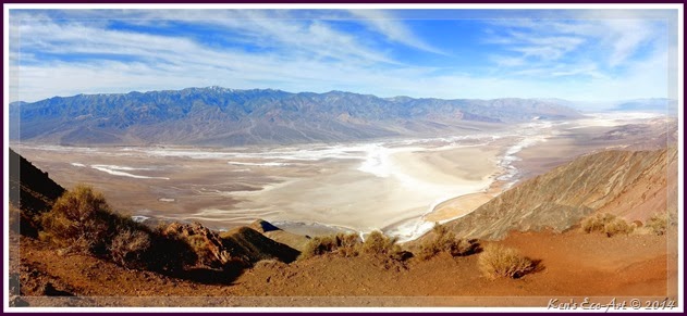
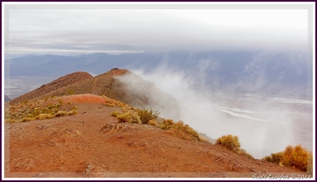
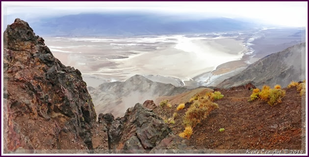
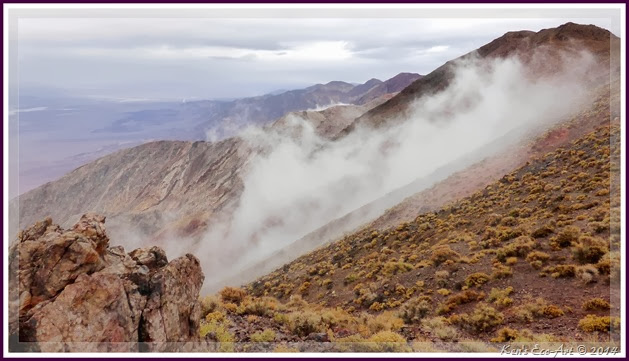
02/28/2014 Trip Notes: Having planned this trip for more than a week, Bob Croke and I decided to give it a shot in spite of the weather forecast of heavy rain by mid-day. The good news was that the rains didn’t really start until after noontime, giving us about 4 hours of exploration. Our first stop was at Dante’s View, the 5,476 foot peak in the Black Mountains. Unlike my previous visit, when the sun was shinning brightly over the valley below (Fig. 01), today the mountain top was shrouded in fast moving clouds (Figs. 03-04) and 25 mph winds that were whipping the mountain, creating a chill factor that was below freezing. As the clouds swept through the valley and swirled up the mountain sides (Fig. 05), they made us feel like we were on top of the world. Our next stop from here was a drive into Twenty Mule Team Canyon on the Twenty Mule Team Road, situated in the old Monte Blanco mining district on the way to Furnace Creek.
|
 |
| (Fig.03) |
|
 |
| (Fig. 04) |
|
 |
| (Fig. 05) |
|
|
|
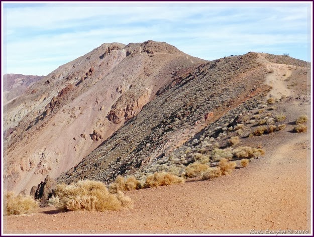
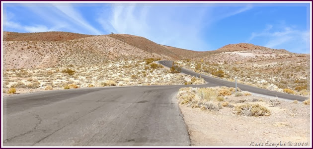
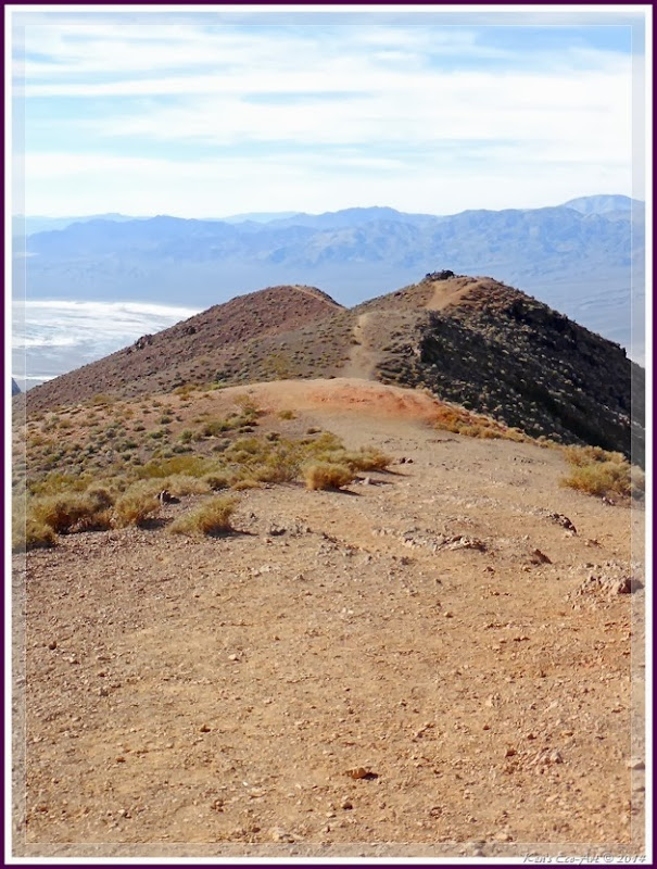
01/25/2014 Trip Notes: On a recent daytrip to Death Valley National Park with my friend Jim Herring (Fig. 09), we decided to make Dante’s View our first stop of the day. All I can say is WOW. I can’t believe that this was my fourth visit to Death Valley and the first time I had ever been to this outstanding location. The first half of the 13-mile drive up Furnace Creek Wash Road from highway 190 is very misleading. This paved paved road heads almost due south until it branches off in a more southwesterly direction onto Dante’s View Road. Climbing all the way, nearing the end of Dante’s View Road you begin to wind your way through several small, narrow canyon areas until you reach a series of open switchbacks (Fig. 06) that lead to the summit. Though we picked the cooler early morning hours, which has the sun behind you for picture taking, the high winds nearly caused us to freeze to death. Dress warm for this visit. From the parking area you are confronted with a path heading west (Fig. 07) which leads to the very brink of the edge, offering dramatic panoramic panoramic view of the southern Death Valley basin (Figs. 08, 09 & 01). To the south (Fig. 08), you can see the Owlshead Mountains, about 19 miles away. To the north, far right of (Fig. 01), you can see the Funeral Mountains, about 31 miles distant beyond Furnace Creek. To the west, across Badwater Basin, is the Panamint Range rises dramatically to the snowcapped Telescope Peak, elevation 11,043 feet, right side of (Fig. 08). To the east is found the Greenwater Range. On very clear days, the highest and lowest points in the contiguous 48 states of the United States: Mount Whitney at 14,505 feet high and Badwater at 282 feet below sea level can be seen.
If you click to enlarge and look carefully in (Fig. 10), a view looking back up to our starting point, you can see the parking lot just to the left of where the trail ends on the right side of the picture. Left of the saddle and the main parking area you can see another 1,000 foot trail that leads up the mountain to a rest area with picnic tables. The low temperatures and the strength of the winds discourage us from climbing up to this spot. One can spend hours hiking around this area soaking in the magnificent views. From here we returned to Hwy 190 and continued onto the Furnace Creek area where we made stops at Golden Canyon, Artists Palette, Devil's Golf Course, and Badwater Basin. See ... Furnace Creek Area - Death Valley National Park.
|
 |
| (Fig. 06) |
|
 |
| (Fig. 07) |
|
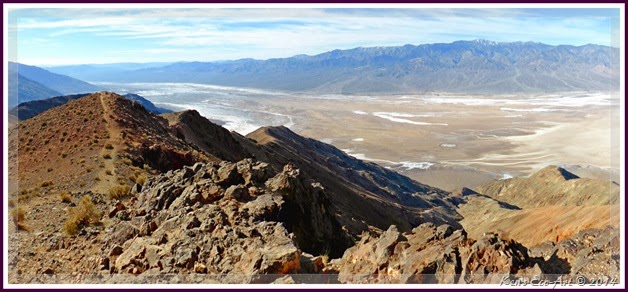 |
| (Fig. 08) |
|
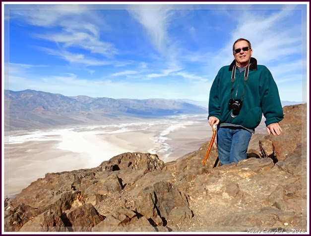 |
| (Fig. 09) |
|
|
|


