{Click on an image to enlarge, then use the back button to return to this page}
 |
| (Fig. 01) |
|
 |
| (Fig. 02) |
|
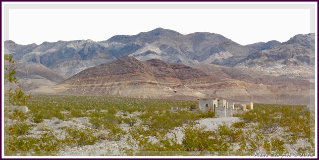
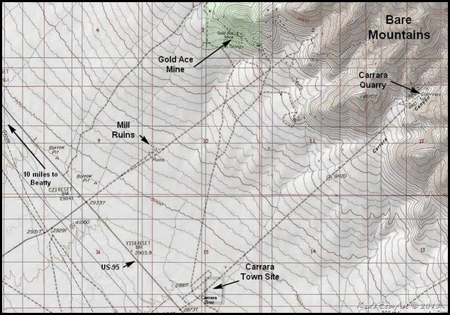
Directions: From Las Vegas, follow US-95 North for approximately 105 miles (approximately 10 miles before the town of Beatty, Nevada). An unmarked dirt road on the right side of the highway (heading northeast) (Fig. 02) will lead you to a set of ruins clearly visible from the highway (Fig. 01). The Gold Ace Mine is located a few miles beyond the ruins in the foothills of the Bare Mountains.
|
 |
| (Fig. 03) |
|
Mine Description: The Gold Ace Mine, elevation 3,684 feet, is located east of US-95, about 10 miles south of Beatty Nevada at the base of the Bare Mountain Range. Located on Federal land, it is accessed from a County public road titled the Gold Ace Mine Road #926010. It was discovered in the early years of the Bullfrog mining boom. Gold-bearing quartz veins, high in base metals, occur in the west-draining canyons and along the western slopes of Bare Mountain. At times this mine produced some very rich gold ore The veins commonly contain calcite as well as quartz, and they fill fault zones and shears that cut Precambrian-Cambrian quartzites, dolomites, and schists. The metal sought at most of the properties in this area was gold, however, silver, copper, lead and zinc commonly provided the most visible minerals at the various properties. Unfortunately, production was "on-and-off" due to the pocket-like nature of the ore's occurrence.
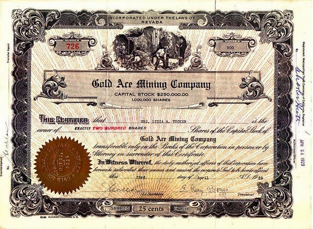
It appears that The Gold Ace Mining Company may have been headquartered in Carrara, a small town just a mile south of the Gold Ace Mine, whose economy was based upon a large marble quarry in the same mountains. (Click here for more info on Carrara ... Ghost Town of Carrara.) In the late spring of 1929 a pocket of very rich gold ore was found, causing the price of Gold Ace stock to temporarily shoot up. In early 1929, a newspaper called the Carrara Miner, began publication. Printed in Los Angeles, it was launched on June 16, 1929, by Bernard M. Stone to help promote a mining excitement and sell stock in the evanescent Gold Ace Mining Company. It lasted only a couple of issues. About the only information I was able to find out about this gold mine is that the Gold Ace Mining Company at Carrara, shut down the mine on December 1, 1929. Though it appears that the mining that occurred here was only for a relatively short period, a somewhat extensive ore processing plant was built just south of the mine . I can’t find any record of how much ore or gold was ever taken out of the mines here. It may be that, as was the case back during the excitement of gold discoveries in the early 1900s, the only money made here was by the owner selling stock shares (Fig. 03) to hopeful investors.
|
|
 |
| (Fig. 04) |
|
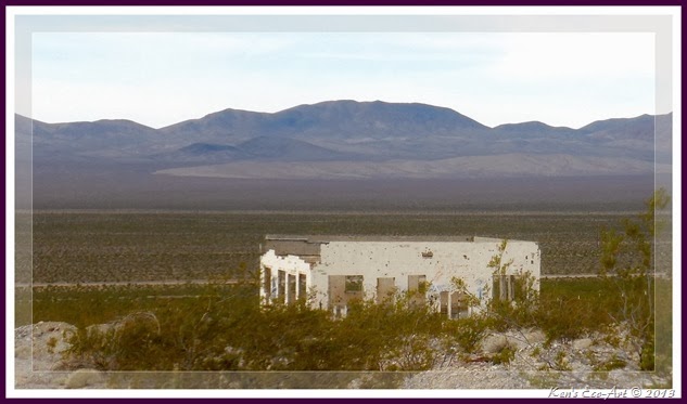
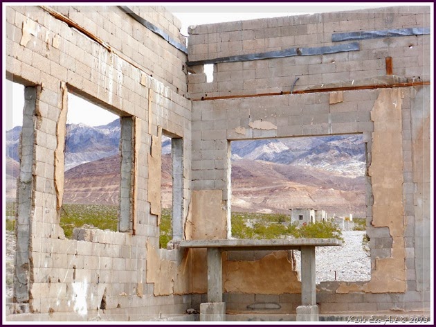
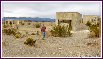
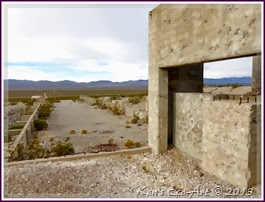
11/07/2013 Trip Notes: On a trip to Beatty and Rhyolite, we stopped at the mill ruins of the long abandoned Gold Ace Mine. There are several structures clearly visible from the highway, the first (Fig. 04) being a rather large, nondescript two story block building with large windows (Fig. 05). This building is so covered with graffiti, that it was hard to get a picture without it. Just a short distance beyond this building were a series of foundations and structures (Figs. 06 & 07) that appeared to be part of an ore milling site. About two miles beyond this site, some of the mine’s structures and tailing piles were clearly visible (Fig. 01). Because we only were able to see one mine opening, we felt that time wise, it was probably not worth unloading the ranger and decided to continue on to Beatty and Rhyolite. After returning home, some further investigation has indicated that there were at least three mine adits and nearly a dozen prospect holes dug here. Now having learned more about this area, I will make additional stops at the ghost towns of Carrara and Gold Center on my next trip through here.
|
 |
| (Fig. 05) |
|
 |
| (Fig. 06) |
|
 |
| (Fig. 07) |
|
|
 |
| Ghost Town of Gold Center, Nevada: Located about three miles south of Beatty, just east of the Amargosa River, its abundant springs made it a critical water source for nearby Bullfrog and Rhyolite. The Amargosa River originated from springs in Springdale, about 10 miles north of Beatty, and flows south down Oasis Valley through Beatty, passing through the Beatty Narrows about a mile south of town and eventually sinks into the Amargosa Valley. It even piped water to the marble mining town of Carrara. Today it is reachable from what is known as Airport Road. Platted in 1904, the origin of Gold Center’s name is a mystery – for it wasn’t the center of anything and it had no gold. Though shafts were sunk, and a 30-ton mill was erected, no valuable ore was ever found. In 1906, the Tonopah and Tidewater Railroad reached Gold Center and the town began to grow. It became the terminus of the Las Vegas & Tonopah Railroad in 1906, and served as the railhead for Rhyolite before that booming camp built its own railhead later in the year. The town reached its peak in 1907. At that time the town had a post office, a hotel, a bank, brokerage firms, a few mercantile stores, and a score of saloons. The most unique and imposing building in Gold Center was the Gold Center Ice and Brewing Company’s combination brewery and icehouse. While it lasted, the company was soon supplying many of the saloons in Gold Center and Rhyolite and at the time had the only distilled water ice plant in Nevada. Gold Center declined around the same time as Rhyolite and Bullfrog circa 1910. Today, its only remains consist mainly of the stone foundations of the brewery and mill. |


