{Click on any image to view full size, then use the back button on your browser to return to this page}
This page last updated on 01/16/2019
 |
| (Fig. 01) |
|
 |
| (Fig. 02) |
|

|
 |
| (Fig. 03) |
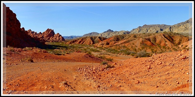
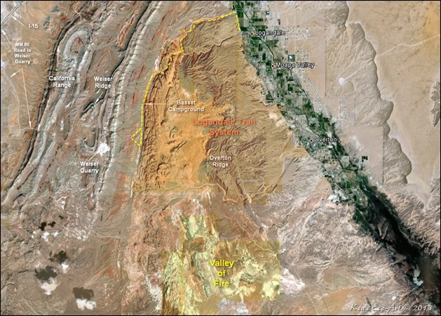
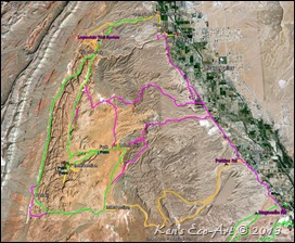
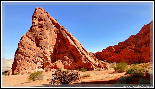
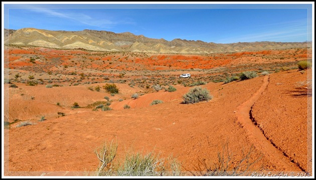
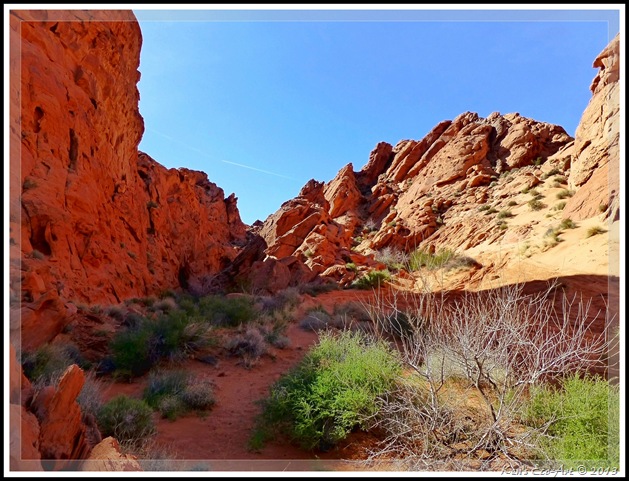
03/11/2013 Trip Notes: While on a trip to Logandale for personal business, Harvey Smith and I decided to take a little side trip to the Logandale Trails inside what is commonly referred to as the Logandale Trails Recreation Area. (see description below for more detail) The dotted yellow line in (Fig. 02 – click to enlarge) shows the route we drove on our way in to (and out of) the large valley area along the western side of main spine of the Redstone outcrop. This desert valley contains the Anderson Wash (to the north) and Logan Wash (Fig. 05) (to the south). We stopped at several locations for some hiking and picture taking. As you can see from the map in (Fig. 03 – click to enlarge) that shows the main trails, we barely scratched the surface of what was available to us here. In fact we never even got to the area where the petroglyphs were. As you can see in (Figs. 01, and 04 thru 06), some of the desert areas and canyons that we hiked provided opportunities for some great views and picture taking. We will definitely be returning here with the Rhino to do some more exploring.
|
 |
| (Fig. 04) |
|
 |
| (Fig. 05) |
|
 |
| (Fig. 06) |
|
|
 |
| (Fig. 07) |
Logandale Trails System: The Logandale Trails System (LTS) is the grouping of more than 200 miles of recreational trails, suitable for a variety of OHV types, as well as hiking and horseback riding, in the spectacular landscape that exists between the township of Logandale and Valley of Fire State Park. As seen in (Fig. 02), it is located between the Overton Ridge and the Weiser Ridge in the north Muddy Mountains. Its southern boundary is the Overton Wash, just north of the Valley of Fire State Park. Since 1973 land to the west and north of the Logandale Trails Recreation Area have been turned over to the Nevada Division of State Parks and subsequently added to the boundaries of the Valley of Fire State Park. Refer to the green shaded areas in (Fig. 07 - click to enlarge). The unusual geology of Logandale was formed out of what was once an inland sea. The conglomerate rock which comprises much of the geology contains a multitude of fossil remains.
A few miles in on the north end entrance, you come to an area that is considered to be the trailhead. It has two shade structures with 8 tables and a restroom building. Several miles further in you will come to the Basset Campground with another restroom building and a hitching post. The trails found here on the western portion are specifically for horseback riding. There are also numerous primitive campsites with fire rings scattered about the trail system; several locations have picnic tables. Note: There are no hookups or dump stations for RVs.
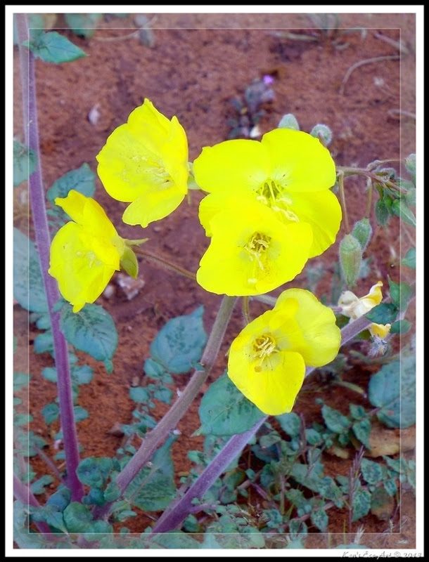
The desert here is home to a variety of plant and animal species, some of which are threatened or endangered. Animals, like the Desert Tortoise, Chuckwallas, The Gila monster, Bald eagles, Gambel’s Qual and bighorn sheep, have all been spotted in the LTS areas. You are also likely to find several rare plant species: the three-cornered milkvetch, the Las Vegas bearpoppy, the two-toned beardtongue, and possibly the sticky buckwheat. The milkvetch, beardtongue, and sticky buckwheat can be found near "The Boot" trail, the main trail in the LTS. During my visit I found a Golden Evening-Primrose (Camissonia brevipes), a.k.a. Yellow Cups, (Fig. 07) near the Basset Campground. Click here to learn more ... Golden Evening Primrose. As can be expected, these plants are more visible in spring, when they bloom. The cryptobiotic soil crusts of the LTS plays an important role in the ecosystem. These delicate plant structures forming the crust of the soil are important for the health of the desert ecosystem since they provide nutrients to the soil and limit erosion.
One of the unique advantages of this area is the opportunity it provides to hike and climb its dozens of magnificent red sandstone cliffs along its main spine, many several hundred feet high. As you ride, bike or hike this extensive trail system, you will be presented with various opportunities to view petroglyphs left hundreds of years ago by early inhabitants of the area. The LTS is the former home of the Virgin Anasazi, a culture that mysteriously left the area around 1150 AD. Other groups came before and after the Anasazi, leaving evidence of their presence in the area. If careful, you will spot rock art, pueblo foundations, and artifacts that indicate the former presence of these cultures. Due to the subtle and sometimes hidden nature of the resources, most visitors pass them by without knowing they exist. Several petroglyph sites are in recesses of rock formations, not visible to the casual passer-by.
|
 |
| (Fig. 08) |
|
___________________________________________________
Note: Every attempt is made to provide accurate information, but occasionally depictions are inaccurate by error of mapping, navigation or cataloging. The information on this site is provided without any warranty, express or implied, and is for informational and historical purposes only.


