{Click on an image to enlarge, then use the back button to return to this page}
This page last updated on 02/18/2019
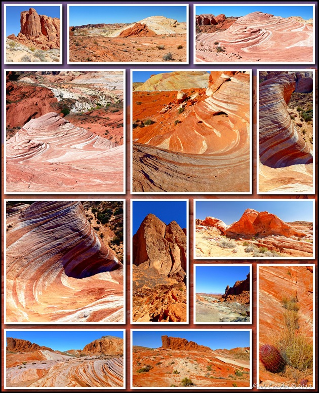 |
02/16/2019 Trip Notes: Today Bob Croke, Cynthia Pace and myself took a guided hike to the Fire Wave. Our guide was Rosa Prasser, Park Interpreter for Nevada Division of State Parks, Valley of Fire State Park (P.O. Box 515, 29450 Valley of Fire Rd., Overton, NV 89040), Tel 702-397-2088,
vofinterpreter@mvdsl.com. Information about future guided hikes can be found here ...
parks.nv.gov. Even though we have all hike here before, we enjoyed the hike and listening to our guide. For pictures and information about this hike, click here ...
Fire Wave (VOF) - 02/16/2019 Trip Notes.
04/23/2015 Trip Notes: Today Blake Smith and I were joined by six rock-hounds from the Henderson Senior Facility for a hike to the Fire Wave. As I have hiked this trail on three previous occasions, I only captured a handful of pictures from the trailhead facing Gibraltar Rock down to the Fire Wave. Scrolling down on this page will provide you with pictures captured on previous visits taken at both of these locations. The majority of the pictures that I took today were taken on our return, hiking the Kaolin Wash back to the main road. In an effort to not mess up the numbering of pictures previously posted here, I placed these pictures on a separate page titled Fire Wave & Kaolin Wash hike. Click this link to view them ...
Fire Wave and Kaolin Wash - 04/23/2015 Trip Notes
01/01/2013 Trip Notes: On New Year’s day we traveled here to take a guided hike to what is becoming one of the Valley of Fire’s most popular hikes, the “Fire Wave” (Fig. 01). As you can see by the way Harvey is bundled up, it was a rather cool morning. Though it was a mere 32-degrees when we left the house, by the time we started the hike it had warmed up to a “brisk” 42-degrees. As one drives north on the White Domes Road, Gibraltar Rock is off to the right just before the road loops back south to end at the parking area near the base of the White Domes. Parking lot #3 on the left side of the road, which also serves as the parking area and trailhead for the Fire Wave trail, is located directly opposite the west side of Gibraltar Rock (Fig. 02). Because you must hike past this structure on the way to the “Fire Wave”, I will cover it first.
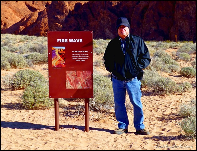 |
| (Fig. 01) |
|
|
 |
| (Fig. 01) |
|
|
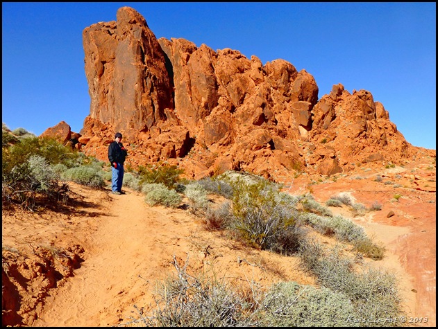
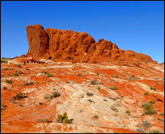
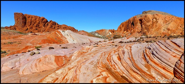
Side Note - Gibraltar Rock: Located just off the road, this large monolithic-like outcrop is a striking formation comprised of red sandstone. There really isn't really much written about this sandstone outcrop. It only takes a few minutes to hike to its western base (Fig. 02). However, if you then continue to hike the trail that heads south along the base for about ten minutes, you will find yourself staring nearly straight up at its highest point (Fig. 03). There are a couple of rather difficult 4 and 5 class hikes to its summit that very few attempt. The further south you hike on the “fire wave” trail, the more spectacular the view of this outcrop becomes (Fig. 04). It seems that the further away you get, the more it acts as the perfect backdrop for the spectacular geology that surrounds it (Figs. 05 and 06).
|
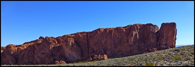 |
| (Fig. 02) |
|
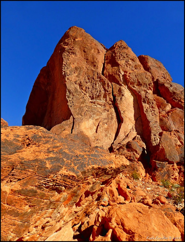 |
| (Fig. 03) |
|
 |
| (Fig. 04) |
|
 |
| (Fig. 05) |
|
 |
| (Fig. 06) |
|
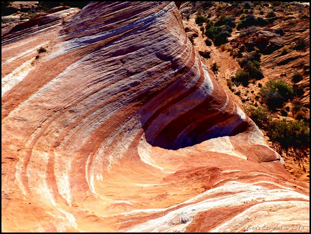
Side Note - The Fire Wave: Images of the Wave appear on the covers of Nevada Tourism brochures and dozens of photography websites, yet with pictures of the Fire Wave everywhere, there is almost no information about how to get to it. These days however, rangers provide more clear directions to the wave to help keep the human impact on the surrounding area to a minimum. Obviously, photography of the Fire Wave is perhaps the main reason why so many people want to hike to it. In addition to the Wave itself, a full spectrum of desert colors can be seen from this location which allows for some brilliant shots. First of all, let me say that the Fire Wave is smaller than most pictures make it out to be. As you can see in (Fig. 09), the whole thing is less than 40 feet long as it dips into a bowl shaped area. It runs in a North-South direction and most of the pictures of it are facing south to highlight its colorful striations. Obviously, different times of the day will offer very diverse opportunities for photography. On my first visit we came in the mid-morning which did not appear to be ideal but still made for some interesting shots.
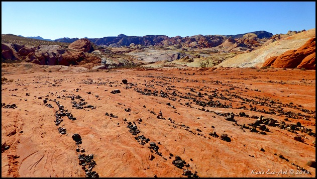
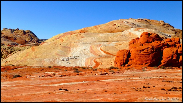
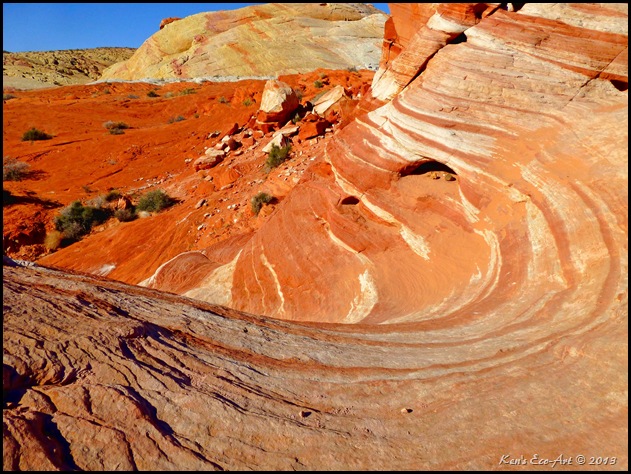
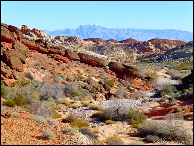
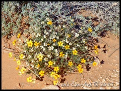
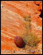
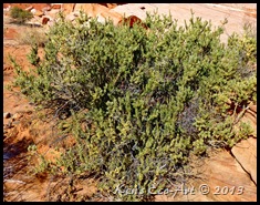
01/01/2013 Trip Notes Continued: From the trailhead noted above, the trail meanders east towards the base of Gibraltar Rock, and then leads south and east around its southern tip to its back side (Fig. 04). It then heads in a south-southeast direction, somewhat parallel to the road for about 1,500 feet until it reaches the “Wave”. Along the way you get to pass some fascinating geologic features. The nearly level surface in (Fig. 07) was strewn with rivulets of smooth, hard stones that almost appear as though someone had arranged them. Not really sure how they all got there. Figure 08 is a close-up of the colorful outcrop shown on the right side of (Fig. 07). Once you reach the “wave” (Fig. 09), I found it to be smaller than I expected, even being somewhat indiscernible until you are literally on top of it. Fortunately there are now more markers marking the route that make it slightly easier to find. The picture in (Fig. 10) is a shot of its backside. Located at the end of a series of sandstone plateaus, it sits directly above a large wash that runs east towards Lake Mead. We both walked down the wash (Fig. 11) for several hundred feet before climbing up its northern bank and heading back towards Gibraltar Rock and the trailhead. The snow capped mountains in the background of (Fig. 11) are actually on the other side of Lake Meade in Arizona. Except for the occasional desert scrub, there really isn't much (Figs. 12, 13, and 14) color out here other than the outstanding sandstone formations. Also check out the pictures from my first visit to the Fire Wave ... Valley of Fire Trip Notes for 06/28/2012.
|
 |
| (Fig. 07) |
|
 |
| (Fig. 08) |
|
 |
| (Fig. 09) |
|
 |
| (Fig. 10) |
|
 |
| (Fig. 11) |
|
 |
| (Fig. 12) |
|
 |
| (Fig. 13) |
|
 |
| (Fig. 14) |
|
___________________________________________________
Note: Every attempt is made to provide accurate information, but occasionally depictions are inaccurate by error of mapping, navigation or cataloging. The information on this site is provided without any warranty, express or implied, and is for informational and historical purposes only.


