Tuesday

Pine Creek Canyon Trail (RRCNCA) - Summary Page

{Click on an image to enlarge, then use the back button to return to this page}
This page last updated on 04/10/2018

E-P1110535
Destination: Pine Creek Canyon Trail (RRCNCA)
Distance from Point of Origin: 36 miles.
Estimated (One Way) Travel Time: 55 minutes.
Directions: From the Stratosphere Casino take a right onto Las Vegas Blvd south (the Strip) to Sahara Ave. Turn right onto West Sahara Ave (NV-589) and continue to follow W. Sahara Ave for 10 miles until it turns into Desert Foothills Drive. Continue on for another 4.5 miles and turn left onto NV-159 W Charleston Blvd. Continue to follow NV-159 (which becomes Blue Diamond Road) west for about 4.5 miles and turn right onto Scenic Drive which leads into the Red Rock Canyon National Conservation Area (RRCNCA). After paying the entrance fee, bear right at the fork to stay on the 16 mile Scenic Loop road. Travel roughly 13 miles past the visitor center, about three quarters of the way around the Scenic Loop, turn right into the parking area for the Pine Creek Canyon. The trailhead is immediately on the right as you enter the parking area.

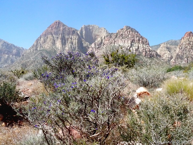
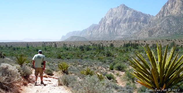
General Description: The Pine Creek Trail is like a lot of the other trails at Red Rock, with several trails that crisscross through a box canyon. Most of these trails are centered around the stream that runs through the center of the canyon in the springtime or when there are heavy rains. This stream is fed by the small springs that themselves feed on the rainwater and snow melt that is stored in the porous sandstone cliffs. The mountain views (shown above) from almost everywhere along this hike are  fantastic; Mt. Wilson to the far left, Rainbow Mountain, Rainbow Wall and Juniper Peak, Mescalito straight ahead and Bridge Mountain on the right. The towering red, black and gray mountains combined with juniper, pine and various deciduous trees create wonderful “color country.” In the fall when the leaves are turning this hike can become a sensory overload and should not be missed!
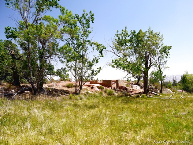
Special Attraction or Points of Interest: Veering of the main trail about 2/3 of the way into this hike will take you along a running stream bed that you can follow for almost a half mile. Depending upon the time of year, you may also find a hidden waterfall at the end. This idyllic canyon was originally settled by a homesteader named Horace Wilson back in the early 1920's. Deep in the canyon the foundation to his home still remains (top picture).
Primary Activity: Hiking.
Secondary Activities: Photographing and birding.

Elevation: 4,025 feet.
Best Time To Visit: Open year-round, the best time to visit is in the early spring and the cooler months of fall and winter.
Difficulty: Easy, except for the climb back up the ridge to the trailhead.
Facilities: Pit Toilets.
Estimated Round-trip Time: Four to five hours depending upon how much hiking, exploring and picture taking you do.
For more info on Pine Creek Canyon go to: http://www.friendsofredrockcanyon.org/pine_creek.php

04/18/2016 Trip Notes: Today was my second visit here.  I was accompanied by fellow hikers Blake Smith and Jim Herring. The weather today was much better than that of my previous visit, clear and sunny with very little haze. We spend more time hiking the trail along the creek and ended up with some very nice pictures. Click the following link pictures and a description of today's hike ... Pine Creek Canyon (RRCNCA).
E-P1110531

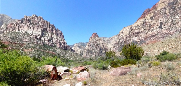
05/10/2012 Trip Notes: Unfortunately, today’s trip with the rock-hounds from the Heritage Park Senior Center was marred by extremely hazy, dusty landscape views in every direction, making it nearly impossible to capture any good photos. The only obstacle at Pine Creek is the rather steep descent from the parking lot down to the canyon leg of the trail. The original access route was much easier. However, because it was longer people began shortcutting down the side of the hill, eventually creating this somewhat challenging 12% grade that has now become the “official” trailhead. Though it doesn’t look steep in the photo above, my thighs ached for three days after the climb back up at the end of our hike. The more we hiked and got closer to the base of the canyon, the less the haze, allowing for a little clearer view. The picture below was taken about halfway between the trailhead and the end of the trail. The red tipped peak in the center of the picture is called Mescalito. In the rear to the right is Yoga Peak; the large ridge-line in the foreground to the right is called the Brass Wall. The pointed peak in the distance to the left of Mescalito is Pine Creek Peak. The ridge-line in the foreground on the left is called Rainbow Wall.

E-P1110540-P1110542

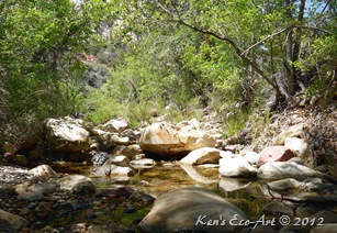
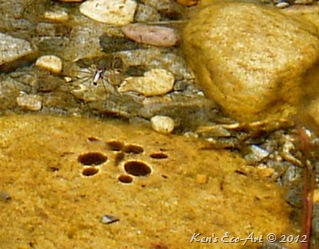
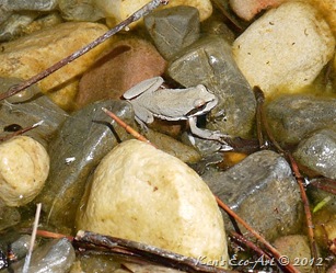
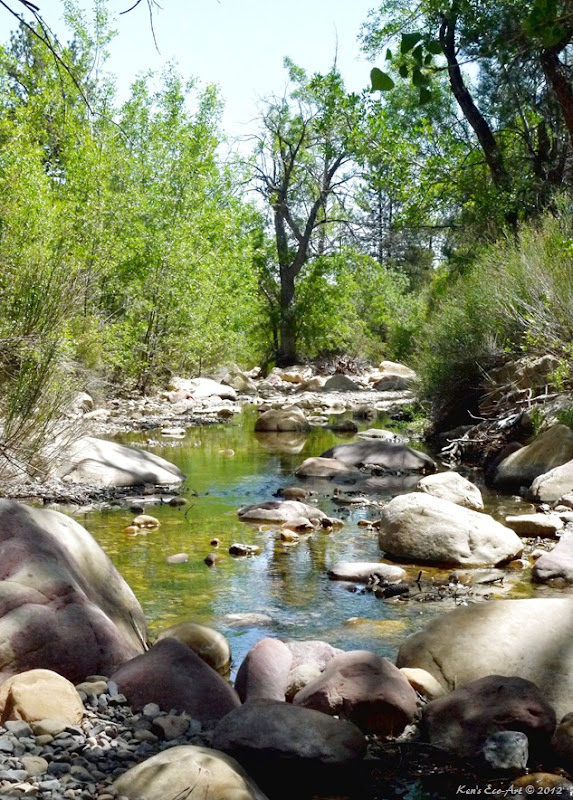
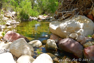
At a trail junction just beyond the halfway point, John and Sandra and I took a side trail that headed southwest  from the main trail, into the ponderosa pine forest and the creek created by the water flowing down Pine Creek Canyon. We hiked along this cool, shady creek bed for almost a quarter mile. The silence was broken only by the occasional sounds birds chirping and water rushing over rocks and fallen trees. Not only were we afforded some beautiful scenic views, we also saw dozens of water spiders skimming across several small pools of water and a couple of tiny frogs.
E-P1110550
E-P1110560 E-P1110553
E-P1110554 E-P1110562

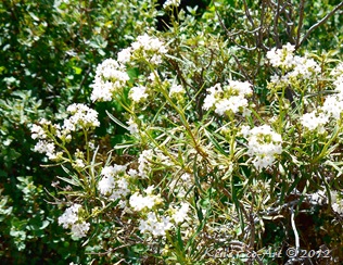
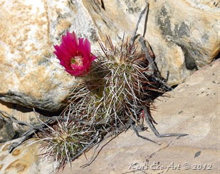
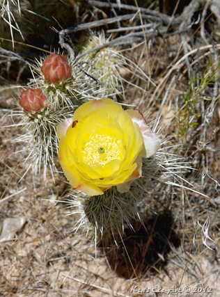
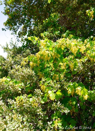
We found a wide variety of vegetation and plant life in various stages of bloom as we hiked along the sides of the stream including several varieties of cacti, wild grasses, Nevada Bluegrass, budding flowers, grapevines, and even some blackberry bushes. After learning about the Wilson homestead (see below), it is probable that he may have planted the grapes and blackberries as part of his garden and orchard.

E-P1110577 E-P1110567
E-P1110570 E-P1110576

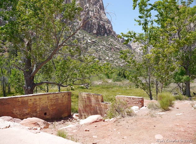
Running out of time, we finally hiked our way back to the main trail and found ourselves opposite what was once the Horace Wilson homestead (below) built in the early 1920’s. After living here for only 10 years, he eventually moved to Las Vegas in 1933. At first glance it seems to be a plain old foundation for a small cabin. The grassy field just below where the house stood, is where Mr. Wilson had his garden and orchards. Even today this fertile spot is still void of rocks, trees and other plant life; almost begging for another planting.
E-P1110578

A closer inspection of the surrounding foundations reveals a structure with a basement that consisted of several rooms. Looking around you slowly begin to experience the history of this place as you imagine what life must have been like for the Wilson family so long ago. You can still see traces of yellow paint on the concrete walls and bits of embedded wood from a window sash. Built somewhat into the hillside, the basement would have been cooler and may have been used for storing food and supplies. If you listen quietly to the singing birds overhead, water bubbling peacefully in the creek below, and wind softly blowing through the canyon, rustling the leaves of the trees, you can get a sense of what it was like to have lived here those many years ago.

E-P1110580

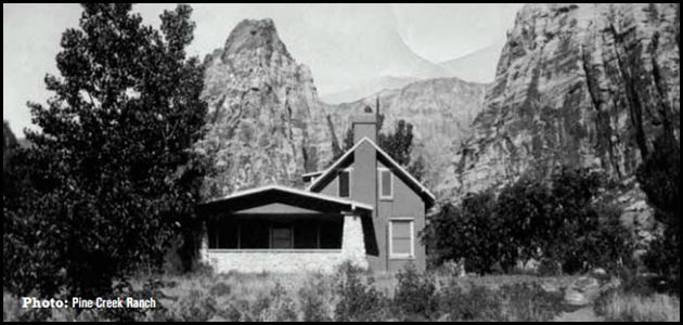
Because there were steps leading up to a rather large concrete slab (lower left of the above picture), we guessed that this was a porch with a door leading into the house. The above picture is looking west out over his garden and orchard with Mescalito Peak directly behind the trees on the right edge of the picture. I found the old black and white picture below of what was called the Pine Tree Ranch in a publication put out by the BLM, Friends of Red Rock Canyon and the Red Rock Canyon Interpretive Association. It proved out theory that the slab on the east side of the house was a large porch. It also shows that the house had two stories, something that we had not imagined.
Pine Creek Ranch
 
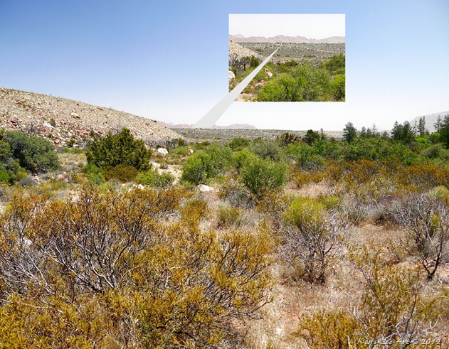
The final shot below is looking eastward towards the trailhead. As we started the hike back, we could just barely see the trail we had to hike up to the top of the ridge and our van in the parking areas at the trailhead on top.
Pine Canyon w-cutout


Play a Slide Show
Clicking the picture-link below will open OneDrive in a new window and a folder containing 54 pictures taken on two hikes at Pine Creek Canyon. To view the show, click on the first picture in the folder and you will get the following menu bar:

Click the "Play slide show" will play a fullscreen window of the slide show.