 |
|
|
Destination: (Lower) Lost Creek Falls Trail - (RRCNCA)
Distance from Point of Origin: 26 miles.
Estimated (One Way) Travel Time: 45 minutes.
Directions: From the Stratosphere Casino take a right onto Las Vegas Blvd south (the Strip) to Sahara Ave. Turn right onto West Sahara Ave (NV-589) and continue to follow W. Sahara Ave for 10 miles until it turns into Desert Foothills Drive. Continue on for another 4.5 miles and turn left onto NV-159 W Charleston Blvd. Continue to follow NV-159 (which becomes Blue Diamond Road) west for about 4.5 miles and turn right onto Scenic Drive which leads into the Red Rock Canyon National Conservation Area (RRCNCA). After paying the entrance fee, bear right at the fork to stay on the 16 mile Scenic Loop road. Travel roughly 8 miles past the visitor center, a little more than half-way around the Scenic Loop. Turn right onto Willow Spring Road and drive north 0.2 miles and park on the left side of the road; this is the trailhead. Lost Creek is located about a mile before Willow Springs Picnic Area.
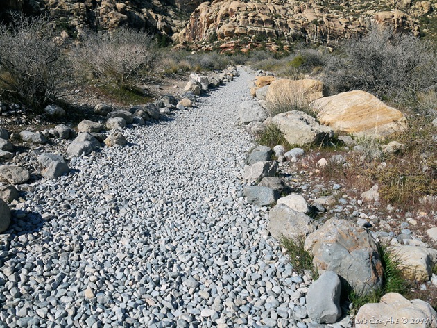
General Description: There are two trails that lead to the Lost Creek Falls, the ‘lower’ trail being the easiest. The ‘upper’ trail goes by some caves and petroglyphs. Lost Creek is a typical of the type of stream that exists in the desert. It is covered with the brush that it sustains and that brush sustains it by protecting the stream from the direct sunlight and increased evaporation. This short trail runs across Red Rock Wash and up a short canyon in the red rock cliffs to a waterfall inside the Rainbow Mountain Wilderness Area. The trail ends in a pretty little box canyon with a waterfall that flows during winter and after rainstorms.
Special Attraction or Points of Interest: There is a spring in the willow thicket at the base of the canyon, before you reach the falls, that almost always has water. This is a good place to look for birds. During extremely wet years, the trail into the canyon can be flooded and travel can be somewhat difficult if you want to keep your feet dry, but the waterfall can be spectacular under those conditions. Also, just a short distance up the road from the trail head to the falls is Willow Springs Picnic Area, a good place to stop for lunch.
Primary Activity: Hiking.
Secondary Activities: Photographing.
Elevation: 4,452 at the trail head to about 4,518 at the falls.
Best Time To Visit: Early Spring.
Difficulty: Easy to Moderate. The "lower" trail is relatively easy. The "upper" trail is a little more difficult. I would suggest walking out on the lower trail (.3 miles) and returning via the upper trail (.5 miles). The upper trail has some serious exposure and is not appropriate for the inexperienced or faint of heart. The route up the hillside is steep and rocky, and at the top of the cliff, you have to find a route across exposed ledges.
Facilities: None.
Estimated Round-trip Time: 4-1/2 hours. |
|
|
The best time to find water flowing at the Lost Creek Falls is early spring or right after a heavy "monsoonal" rain during July and August.
|
|
|
(OPTION 1) Each show is designed to run automatically in place, without leaving the current browser window. If the show is not already running, just click the large "Play" button in the middle of the picture and let it run.
(OPTION 2) Running the cursor over the picture being shown will PAUSE the show and bring up a navigation bar at the bottom of the slideshow window with Pause, Forward and Back buttons, allowing you to start, stop or manually forward or back up pictures one at a time.
|
|
|
| Slideshow Description: The slideshow above contains 24 pictures that were taken along the lower Lost Creek Falls trail. |
|